


RC3000 Antenna Controller Chapter 1 Introduction
14
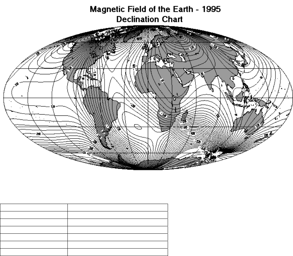
1.3.8 Magnetic Variation
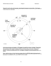
In order to calculate satellite pointing solutions, the mount’s orientation with respect to true North must be
known. The RC3000 uses the fluxgate compass to measure the local horizontal component of the earth’s
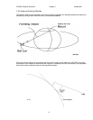
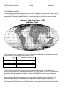
magnetic field. The earth’s magnetic field is very irregular as shown in the following diagram from the
National Geophysical Data Center.
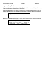
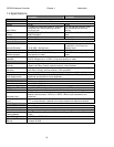
The magnetic field also changes slowly over time. The following table shows how the magnetic variation
for Washington D.C. has changed over the last 250 years.
YEAR MAGNETIC VARIATION
1750 -3.3
1800 -1.0
1850 -2.5
1900 -5.5
1950 -7.5
2000 -10.6
To calculate the local magnetic variation (difference between magnetic North and true North), the
RC3000 uses the International Geomagnetic Reference Field (IGRF) model. The IGRF is a mathematical
model of the earth’s magnetic field and how it is changing. The IGRF is based on world wide
observations and is updated every five years. The IGRF model cannot account for short term effects
such as magnetic storms, etc.
Local magnetic variation is calculated given the mount’s latitude, longitude and the current date. The
magnetic variation calculation cannot account for isolated local anomalies (typically less then a few
degrees). It also cannot account for local external effects (power lines, train tracks, etc). The autopeak
scan functions (3.2.2.3.2.3) used by the RC3000 attempt to compensate for the small heading calculation
errors that may occur at any particular location.