


MARINE MODE PAGES AND FEATURES
Marine Mode operates in a similar fashion to Aviation Mode, while
also providing many features and operations of Automotive Mode.
Refer to the corresponding sections in the Aviation and Automotive
sections for further details.
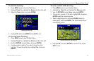
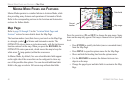
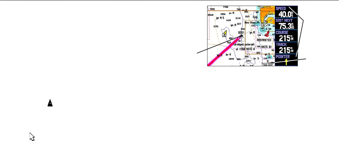
Map Page
Refer to page 28 through 35 in the “Aviation Mode Pages and
Features” section for more details about the Map Page.
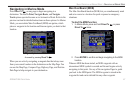
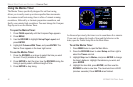
The location marker (icon) that shows your travel on the Map Page
is a triangle symbol in Marine and Automotive modes. The
GPSMAP 296 always turns on in location mode, with the last known
location centered on the map. When you press the ROCKER, the
GPSMAP 296 enters pan mode, which moves the map to keep the
white arrow (map pointer) within the screen area.
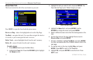
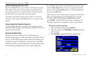
In Marine Mode, by default, five user-selectable data fields appear
on the right side of the screen that can be configured to show any
one of the possible data options. You can also add additional data
fields to the page or select a full screen map without data fields.
Map Page
Data fields
Map range
Current
location
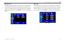
Press the zoom keys (IN and OUT) to change the map range. Some
items on the map only appear if the map is zoomed in to a specified
level.
• Press
ENTER to quickly declutter (remove unwanted items)
from the Map Page.
• Press
MENU to open the options menu for the Map Page.
• Show and hide the heading line from the options menu.
• Use the
ROCKER to measure the distance between two
objects on the map.
• Change the page layout and data fields to customize the Map
Page.
88 GPSMAP 296 Pilot’s Guide
MARINE MODE PAGES AND FEATURES > MAP PAGE