


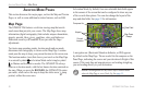
AVIATION MODE PAGES
This section discusses the major pages, such as the Map and Terrain
Pages, as well as some additional aviation features, such as E6B.
Map Page
The GPSMAP 296 features a real-time moving map that can do
much more than just plot your course. The Map Page shows map
information (digital cartography) that includes airspace boundaries,
airports, navaids, lakes, rivers, coastlines, cities, and highways.
Dedicated zoom keys (IN and OUT) are provided for range
adjustments.
Two basic map operating modes,
location mode and pan mode,
determine what cartography is shown on the Map Page. Location
mode pans the map to keep your present location in the screen area.
The location marker (icon) that shows your travel on the Map Page
is an aircraft symbol in Aviation Mode and a triangle symbol
in Marine and Automotive modes. The GPSMAP 296 always
turns on in location mode, with the last known location centered on
the map. When you press the ROCKER, the GPSMAP 296 enters
pan mode, which moves the map to keep the white arrow (map
pointer) within the screen area.
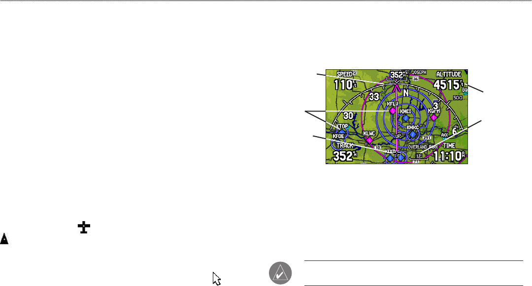
In Aviation Mode, by default, four user-selectable data fields appear
in the corners of the screen that can be configured to show any one
of the several data options. You can also change the layout of the
map and data fields. See page 33 for information.
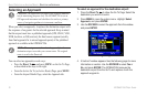
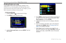
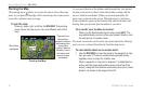
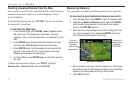
Map Page (Aviation Mode)
Data Field
Current
Location
Map Zoom
Range
Compass Arc
Airports
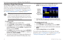
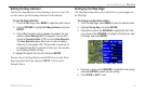
A navigation arc (Horizontal Situation Indicator, or HSI) appears
by default on the Map Page. The arc works like the compass on the
Panel Page, indicating the course and your deviation left/right of this
course. If the route line and magenta arrow are heading straight up,
you are heading directly to your destination.
NOTE: The navigation arc only shows up in Aviation Mode
when the Map Page is set to Track Up. See page 33.
28 GPSMAP 296 Pilot’s Guide
AVIATION MODE PAGES > MAP PAGE