


Failure to avoid the following potentially hazardous situations could
result in an accident or collision resulting in death or serious injury.
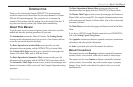
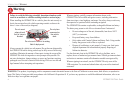
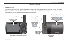
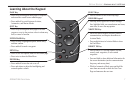
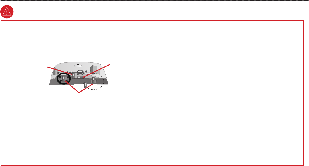
When installing the GPSMAP 296 in a vehicle, place the unit securely so
that it does not interfere with vehicle operating controls or obstruct the
driver’s view of the road (see diagram).
Do not mount
where driver’s
field of vision is
blocked.
Do not place
unsecured on
the vehicle
dash.
Do not mount in front of an airbag
field of deployment.
Always operate the vehicle in a safe manner. Do not become distracted by
the GPSMAP 296 while driving, and always be fully aware of all driving
conditions. Minimize the amount of time spent viewing the screen of the
GPSMAP 296 while driving and use voice prompts when possible. Do
not enter destinations, change settings, or access any functions requiring
prolonged use of the unit’s controls while driving. Pull over in a safe and
legal manner before attempting such operations.
When navigating, carefully compare information shown on the
GPSMAP 296 to all available navigation sources, including information
from street signs, visual sightings, and maps. For safety, always resolve any
discrepancies or questions before continuing navigation.
The GPSMAP 296 contains a replaceable, rechargeable lithium-ion battery.
The battery may present a risk of fire or chemical burn if mistreated.
• Do not recharge out of the unit, disassemble, heat above 140°F
(60°C), or incinerate.
• Keep used battery away from children.
• Only replace with Garmin Lithium-ion Battery Pack. Using another
battery may present a risk of fire or explosion.
• Dispose of used battery or unit properly. Contact your local waste
disposal department for information on properly disposing of
lithium-ion batteries.
Use the electronic chart in the GPSMAP 296 only to facilitate, not to
replace, the use of authorized government charts. Official government charts
and notices to mariners contain all information needed to navigate safely.
When navigating in an aircraft, use the GPSMAP 296 only as an aid for
VFR navigation. Use terrain and obstacle data only as an aid to situational
awareness.
Warning
WARNING: This product, its packaging, and its components contain chemicals known to the State of California to cause cancer, birth defects, or reproductive
harm. This Notice is being provided in accordance with California’s Proposition 65. If you have any questions or would like additional information, refer to our
Web site at
http://www.garmin.com/prop65.
iv GPSMAP 296 Pilot’s Guide
INTRODUCTION > WARNING