


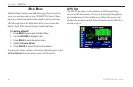

To view Sun & Moon information for a different
location:
1. Use the ROCKER to highlight the From field, and
press ENTER.
2. Highlight Use Find Menu, and press ENTER. The Find Menu
automatically opens.
3. Select a waypoint or point of interest, and press ENTER.
4. On the waypoint information page, press ENTER. The unit
shows the sun and moon information for the location you
selected.
To use the current location, highlight the From field. Press ENTER,
highlight Current Location, and press ENTER.
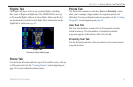
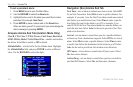
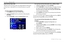
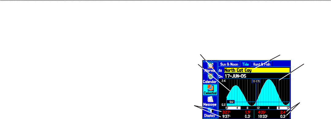
Tide Sub Tab
The Tide sub tab contains a graphical chart that shows tide station
information in a 24-hour span starting at midnight station time. You
can choose from different dates and over 3,000 tide stations.
Height of tide
Smallest and
Largest tides
for the AM
hours
Select the Tide Station for which you
want to view the information
Tide Tab
Enter the Date for which you want to
view the tide information
Time
Smallest and
Largest tides
for the PM
hours
The top of the page shows the tide station and date being referenced.
The chart shows a 24-hour block of time, with the time progressing
from left to right. The solid vertical lines represent 4-hour
increments; the dotted vertical lines represent 1-hour increments.
The tide curve shows as a shaded area, with higher tides being taller
and lower tides shorter. The bottom of the page indicates the times
with the largest and smallest tides.
104 GPSMAP 296 Pilot’s Guide
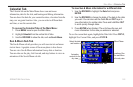
MAIN MENU > CELESTIAL TAB