


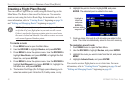
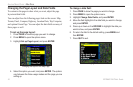
Panning the Map
The panning arrow allows you to pan the map to show other map
areas. As you pan past the edge of the current map, the screen moves
to provide continuous map coverage.
To pan the map:
Press up, down, right, or left on the ROCKER. The panning
arrow moves the map so you can view different parts of the
map.
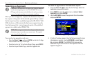
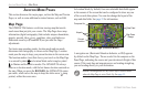
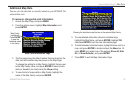
Panning the Map
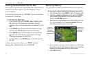
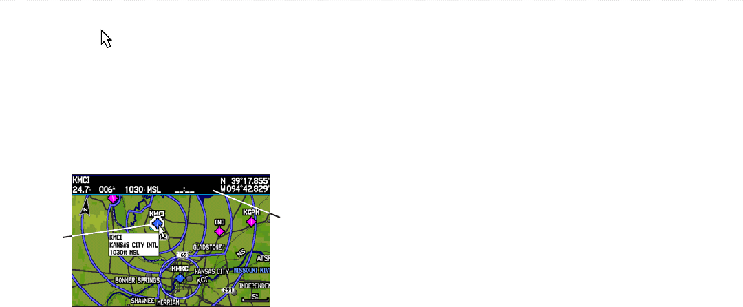
Map feature
highlighted
Panning Arrow
data window:
shows the distance
and bearing from
your present
location, feature’s
elevation, time to
the feature, and
arrow’s location
coordinates.
As you move the arrow, the distance and bearing from your present
location to the arrow is shown in the data window, along with the
arrow’s location coordinates. When you zoom in pan mode, the
arrow stays centered on the screen. When the arrow is stationary,
fixed coordinates appear in the location field, and the distance and
bearing from your present location update as you move.
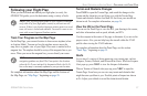
To re-center your location on-screen:
When you are finished panning the map, press QUIT. The
map automatically moves to show your present location, and
the unit returns to location mode.
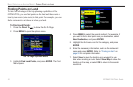
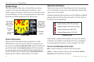
The arrow can also be used to select on-screen map items, allowing
you to review a selected item directly from the map screen.
To
view details about an on-screen point:
1. Use the ROCKER to move the arrow to the waypoint or map
item you want. If there are several items grouped closely
together, zoom in closer for a better view.
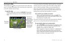
When a waypoint or map item is selected, it is highlighted on
screen with the name and location shown at the top of the
screen, along with the distance and bearing from your current
location, as shown in the image to the left.
30 GPSMAP 296 Pilot’s Guide
AVIATION MODE PAGES > MAP PAGE