


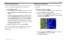
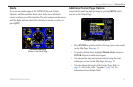

VNAV (Vertical Navigation)
The VNAV sub tab in the Main Menu provides settings for the
vertical navigation feature. These settings create a three-dimensional
profile that guides you from your present location and altitude to a
final (target) altitude at a specified location.
When the VNAV profile is defined, message
alerts help keep you
informed of your progress. The teal bar on the HSI on the Panel
Page shows your VNAV profile.
To use the vertical navigation feature, your ground speed must be
greater than 35 knots and you must be navigating a Go To or a route.
The “Approaching VNAV Profile” message appears one minute
prior to the initial descent point. The descent angle locks to prevent
changes in speed from altering the profile. The VNAV feature does
not take into account any changes in groundspeed that occur during
the transition from level flight to descent or climb.
At 500 ft above the target altitude, the “Approaching Target
Altitude” message appears, the time to vertical navigation goes
blank, and the VNAV indicator disappears from the Panel Page.
CAUTION: The GPSMAP 296 is a VFR navigation tool and
should not be used to perform instrument approaches. VNAV is
only a VFR navigation aid and is not intended for instrument
approaches.
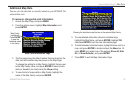
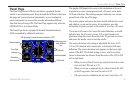
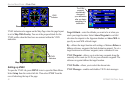
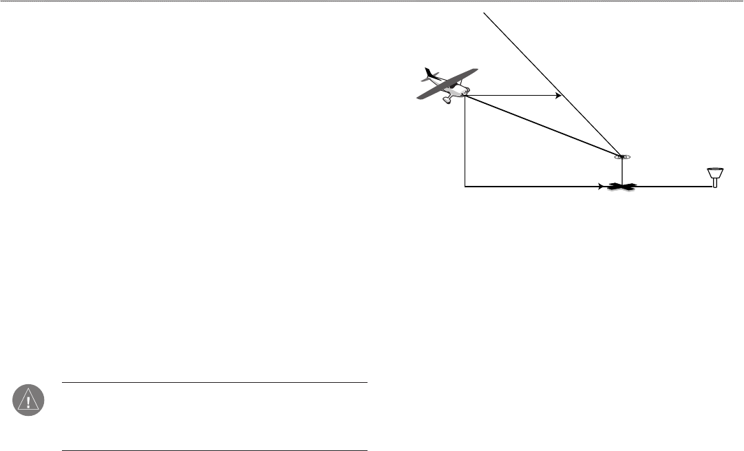
VNAV Profile
Glide Ratio to Target
Distance to Target
Distance to Profile
Target Altitude
Airport
Visual Representation of VNAV
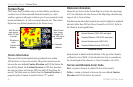
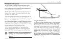
Using the VNAV Feature
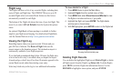
Use the VNAV (Vertical Navigation) feature to ensure that you are
flying at the proper altitude. The VNAV Indicator appears on the
HSI (Panel Page) as a horizontal teal bar, as shown in the image on
the next page. A message appears when you are approaching the
VNAV Profile. When the bar is in the vertical center of the HSI, you
are at the proper altitude for the VNAV Profile. Make sure VNAV
Indicator is On in the options menu. From the Panel Page, press
MENU to open the options menu. Select Capture VNAV Profile,
and press ENTER to center or re-center the VNAV indicator on
the graphic HSI. You must have entered a valid vertical navigation
profile and be navigating.
GPSMAP 296 Pilot’s Guide 41
AVIATION MODE PAGES > PANEL PAGE