


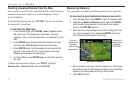

Clearing Unwanted Details from the Map
You can remove items from the map (declutter the screen) to remove
unwanted items, such as highways. Aviation Mode has various
levels of declutter.
To quickly declutter the map, press
ENTER. You can also declutter
the map on the Terrain Page.
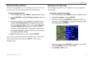
To
declutter the Map Page:
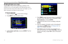
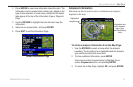
1. From the Map Page, press ENTER. Clear-1 appears under
the map range. The background map detail—including
highways, cities, rivers & smaller lakes—is removed from the
map.
2. Press ENTER again. Airspace boundary detail is removed
from the map. Clear-2 appears below the map range.
3. Press ENTER again. Only the waypoints and navaids that
are part of the current Go To or route appear on the map.
Clear-3 appears below the map range.
4. In Aviation Mode, press ENTER again to return ALL detail to
the map.
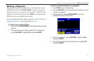
In Marine and Automotive Modes, press MENU, highlight
Declutter On or Declutter Off, and press ENTER.
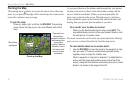
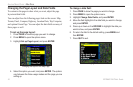
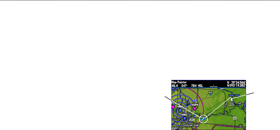
Measuring Distance
You can measure the distance and bearing between two map items.
To measure the bearing/distance between two points:
1. From the Map Page, press MENU to open the options menu.
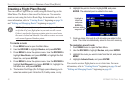
2. Highlight the Measure Distance option, and press ENTER.
An on-screen arrow appears on the map at your present
location with ENT REF below it.
3. Move the arrow to the reference point (the starting point that
you want to measure from), and press ENTER. A push-pin
icon marks the starting point on the map.
Measure Distance
Push pin
indicating the
beginning
point of the
measurement
End point of
measurement,
labeled
“ENT REF”
4. Move the arrow to the point want to measure to. The bearing
and distance from the reference point and arrow coordinates
appear in the data window at the top of the screen.
5. Press QUIT to finish.
32 GPSMAP 296 Pilot’s Guide
AVIATION MODE PAGES > MAP PAGE