


GPSMAP 400/500 Series Owner’s Manual 21
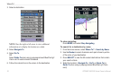
Using Charts
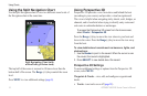
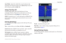
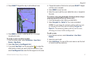
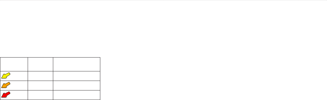
Current direction indicators appear as arrows on the chart. The
direction of each arrow indicates the direction of the current at
a specic location on the chart. The color of the current arrow
indicates the range of speed for the current at that location. When
you move the cursor over the current direction indicator, the specic
current speed at the location appears above the direction indicator.
Direction
Indicator
Color Current Speed
Range
Yellow 0 to 1 knot
Orange 1 to 2 knots
Red 2 or more knots
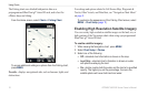
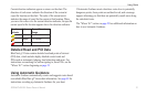
Detailed Road and POI Data
BlueChart g2 Vision contains detailed road and points of interest
(POI) data, which includes highly detailed coastal roads and
POIs such as restaurants, lodging, local attractions and more. For
instructions on searching for, and navigating to, these POIs, see the
“Where To?” section beginning on page 23.
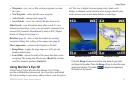
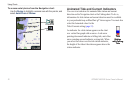
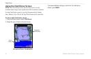
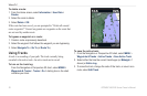
Using Automatic Guidance
Automatic Guidance automatically creates and suggests routes based
on available BlueChart g2 Vision chart information. See page 49 for
instructions on setting up Automatic Guidance for your boat.
If Automatic Guidance must calculate a route close to potentially
dangerous points, those points are outlined in red, and a message
appears informing you that there are potentially unsafe areas along
the calculated route.
The “Where To?” section on page 23 has additional information on
how to use Automatic Guidance.