


18 GPSMAP 400/500 Series Owner’s Manual
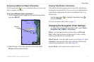
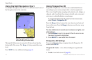
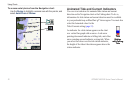
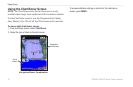
Using Charts
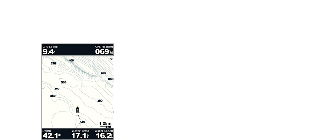
The Fishing chart uses detailed bathymetric data on a
preprogrammed BlueChart g2 Vision SD card, and is best for
offshore deep-sea shing.
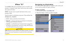
From the Home screen, select Charts > Fishing Chart.
To access additional settings or options from the Fishing chart,
press MENU.
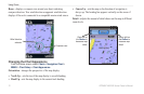
Navaids—displays navigational aids, such as beacons, lights, and
obstructions.
For settings and options related to Full Screen Map, Waypoints &
Tracks, Other Vessels, and Data Bars, see “Navigation Chart Menu”
on page 8.
To customize the appearance of the Fishing Chart screen, select
MENU > Chart Setup (page 11).
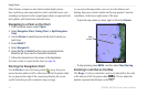
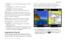
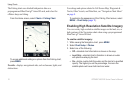
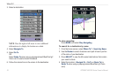
Enabling High Resolution Satellite Imagery
You can overlay high-resolution satellite images on the land, sea, or
both portions of the Navigation chart when using a preprogrammed
BlueChart g2 Vision SD card.
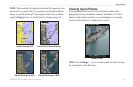
To enable satellite imagery:
1. While viewing the Navigation chart, press MENU.
2. Select Chart Setup > Photos.
3. Select one of the following:
Off—standard chart information is shown on the map.
Land Only—standard chart information is shown on water
with photos overlaying the land.
On—photos overlay both the water and the land at a specied
opacity. The higher you set the percentage, the more the
satellite photos will cover both land and water.
•
•
•