


6 GPSMAP 400/500 Series Owner’s Manual
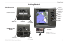
Getting Started
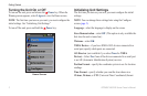
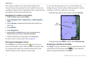
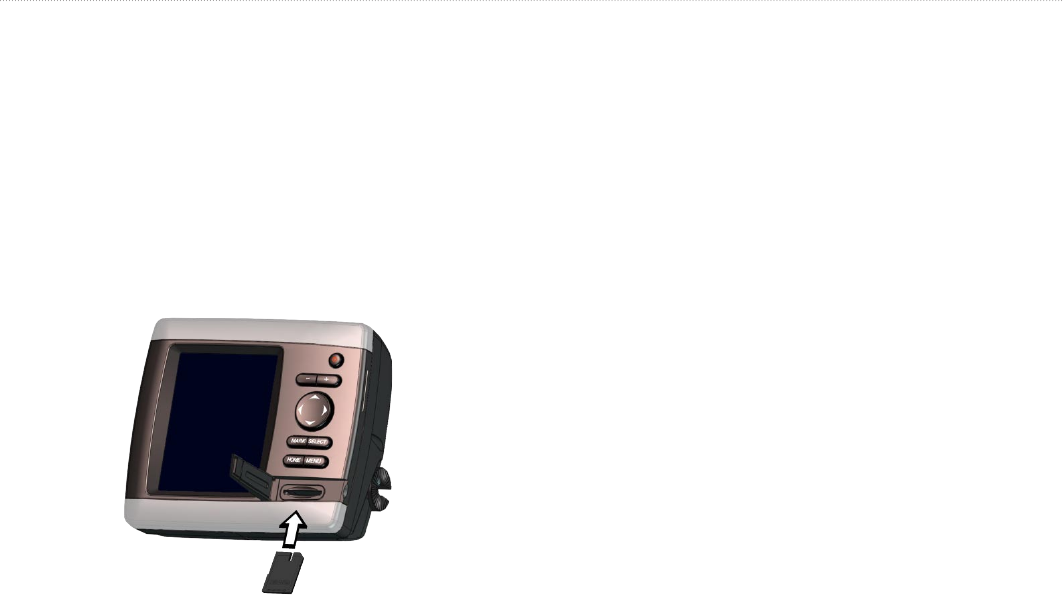
Inserting and Removing SD Cards
Your unit supports Secure Digital (SD) cards. Insert optional
BlueChart
®
g2 Vision
®
SD cards to view high-resolution satellite
imagery and reference photos of ports, harbors, marinas, and other
points of interest. Use SD cards to transfer data such as waypoints,
routes, and tracks to another compatible Garmin unit or a computer
(page 40). The SD card slot is on the lower-right corner of the unit.
To insert the SD card, open the access door and press the SD card in
until it clicks. Press the card in again and release it to eject it from
the chartplotter.
NOTE: If you use an SD card to transfer waypoints from
MapSource
®
or HomePort
™
, update to the most-current version by
clicking Help > Check for Software Updates, or check the Garmin
Web site at www.garmin.com.
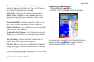
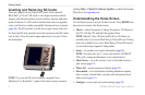
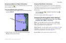
Understanding the Home Screen
Use the Home screen to access all other screens. Press HOME from
any screen to return to the Home screen.
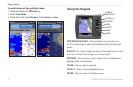
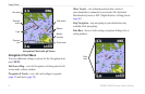
Charts—selects Navigation, Fishing, Perspective 3D, Mariner’s
Eye 3D, Fish Eye 3D, and Split Navigation charts.
NOTE
: Mariner’s Eye 3D charts and Fish Eye 3D charts are
available only if you use a BlueChart g2 Vision SD card. Fishing
charts are available if you use a BlueChart g2 Vision SD card or
if your built-in map supports Fishing charts.
Sonar—set up and access sonar information (page 56).
NOTE
: You must have an “s” series unit (such as a GPSMAP
526s) with a connected transducer to use sonar features.
Chart/Sonar—set up the screen to view a chart and sonar in a
split screen (page 22).
Where To?
—access navigation features (page 23).
Information
—view information including dashboard options,
tides, currents, celestial data, user data, and information about
other vessels (page 31).
Congure—access unit and system settings (page 47).
•
•
•
•
•
•