


GPSMAP 400/500 Series Owner’s Manual 13
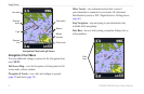
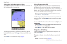
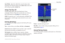
Using Charts
Heading Line—draws an extension line from the bow of the boat in
the direction of travel.
Off—turns the heading line off.
Distance
—sets the distance to the end of the heading line.
Time—sets the amount of time until you reach the end of the
heading line.
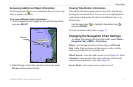
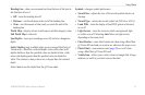
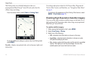
World Map
—displays a basic world map or satellite imagery (when
Full World Map is selected).
Spot Depths
—turns spot soundings on or off, and sets a dangerous
depth.
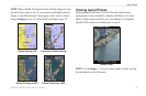
Safety Shading (only available when you are using a BlueChart g2
Vision card)—identies a selected depth. Areas on the chart with
depths shallower than the specied value are shaded in blue, while
areas with depths greater than the specied value are shaded in
white. The contour is always drawn at, or deeper than, the selected
depth.
Select Auto to use the depth from the g2 Vision chart.
•
•
•
Symbols—changes symbol preferences.
Navaid Size—adjusts the size of the navaid symbols shown on
the map.
Navaid Type—selects the navaid symbol set (NOAA or IALA).
Land POIs
—turns the display of land POIs (points of interest)
on or off
Light Sectors—turns the sector in which a navigational light
is visible on or off. Selecting Auto lters out light sectors,
depending on the zoom level.
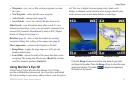
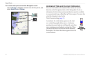
Chart Borders
—turns chart borders on when using a BlueChart
g2 Vision SD card and you want to see what area the maps cover.
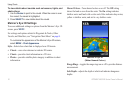
Photo Points—turns camera icons (page 20) on or off when
using a BlueChart g2 Vision SD card.
Vehicle Icon
—allows you to select a boat or triangle that is large,
medium, or small as your boat icon on the chart.
•
•
•
•
•
•
•