46
Various Settings
Using the AREA SHOT mode
By manually switching between guidance points,
both previous and next guidance points can be
confirmed during guidance. Intersection street
names and the direction of turns are shown on
the display in text and with arrows.
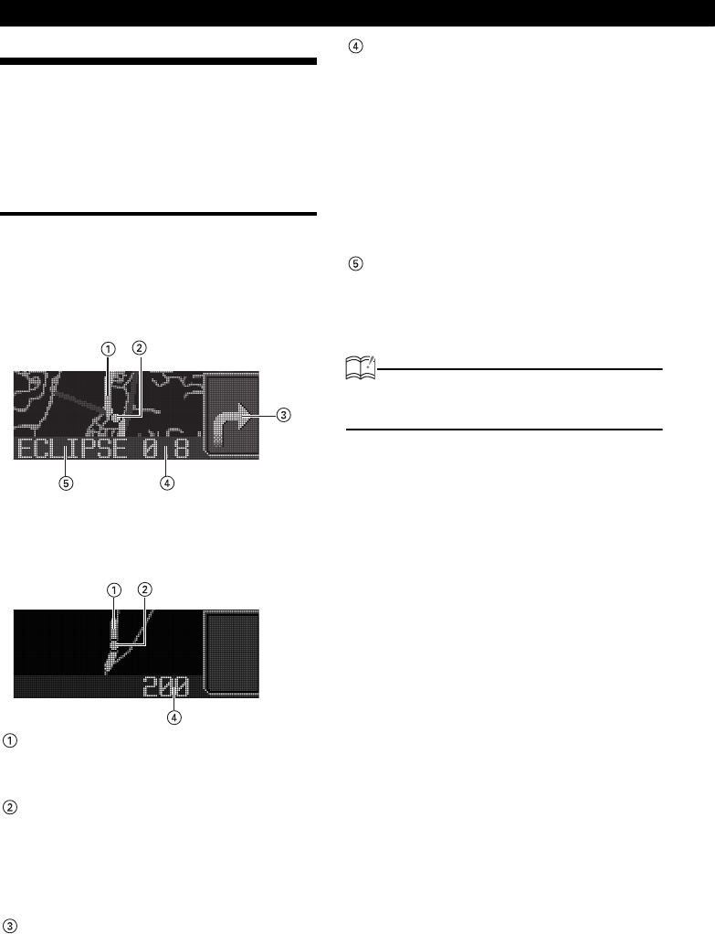
AREA SHOT Screen Configuration
The two following map types can be displayed in
Area Shot mode
• Guidance point map:
Displays a map on which the guidance point
is centered.
.
• Guidance point route map:
Displays a map showing the route to the next
guidance point.
Route display:
The route to the destination point is
displayed in purple.
Vehicle position mark:
If an optional GPS unit (GPS105) is
connected, your vehicle position will be
displayed. The vehicle position mark will
move on the map in accordance with your
vehicle's movement.
Arrows (intersection map only):
Current traveling direction is indicated by
arrow.
Distance display:
If an optional GPS unit (GPS105) is not
connected, the distance between the
previous intersection and the next one will
be displayed.
If an optional GPS unit (GPS105) is
connected, the distance from your vehicle
position to the next intersection will be
displayed (the displayed distance may vary
in accuracy depending on the quality of GPS
reception).
Text information (guidance point map only):
Information about guidance points (traveling
direction, street names) is displayed as text.
ATTENTION
The display in this manual may differ from that
of the accrual product.


