


16 GPSMAP 400/500 Series Owner’s Manual
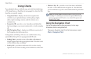
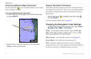
Using Charts
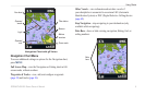
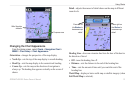
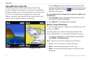
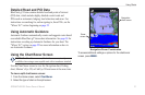
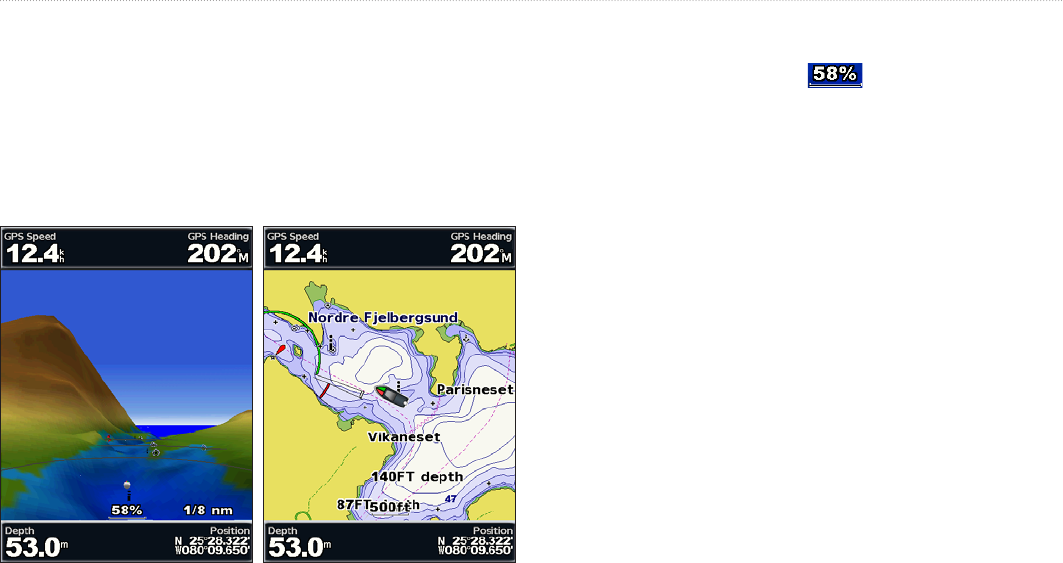
Using Mariner’s Eye 3D
A BlueChart g2 Vision SD card offers Mariner’s Eye 3D, that
provides a detailed three-dimensional view from above and behind
the boat (according to your course), and provides a visual navigation
aid. This view is helpful when navigating tricky shoals, reefs,
bridges, or channels, and is benecial when trying to identify entry
and exit routes in unfamiliar harbors or anchorages.
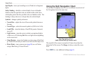
Mariner's Eye 3D Navigation Chart
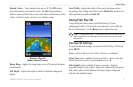
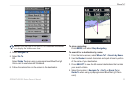
Press the Range (+) key to move the view closer to your boat
and lower to the water. Press the Range (-) key to move the view
away from the boat. The scale ( ) temporarily appears at
the bottom of the screen.
To view details about navaids such as beacons, lights, and
obstructions:
1. Use the Rocker to point to the navaid. When the cursor is over
the navaid, the navaid is highlighted.
2. Press SELECT to view details about the navaid.
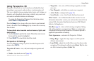
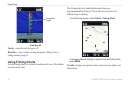
Mariner’s Eye 3D Settings
To access additional settings or options from the Mariner’s Eye 3D
screen, press MENU.
For settings and options related to Waypoints & Tracks, Other
Vessels, and Data Bars, see “Navigation Chart Menu” on page 9.
To customize the appearance of the Mariner’s Eye 3D screen,
select MENU > Chart Appearance.
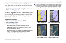
Style—Selects how chart data is displayed over 3D terrain.
Classic—uses color schemes to indicate 3D terrain.
Charts—provides chart information in a 3D view.
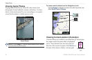
Photos—provides satellite photo imagery in addition to chart
information.
•
•
•