


GDL 30A Owner’s Manual 11
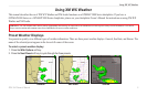
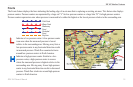
Hurricanes
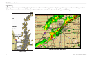
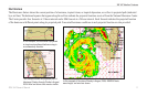
The Hurricanes feature shows the current position of a hurricane, tropical storm, or tropical depression, as well as its projected path (indicated
by a red line). The darkened squares that appear along the red line indicate the projected locations received from the National Hurricane Center.
The Center provides four forecasts at 12-hour intervals and a fth forecast at a 24-hour interval. Each forecast indicates the projected location
of the hurricane at different points along its projected path. Forecasted hurricane conditions at each projected location are also provided.
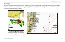
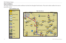
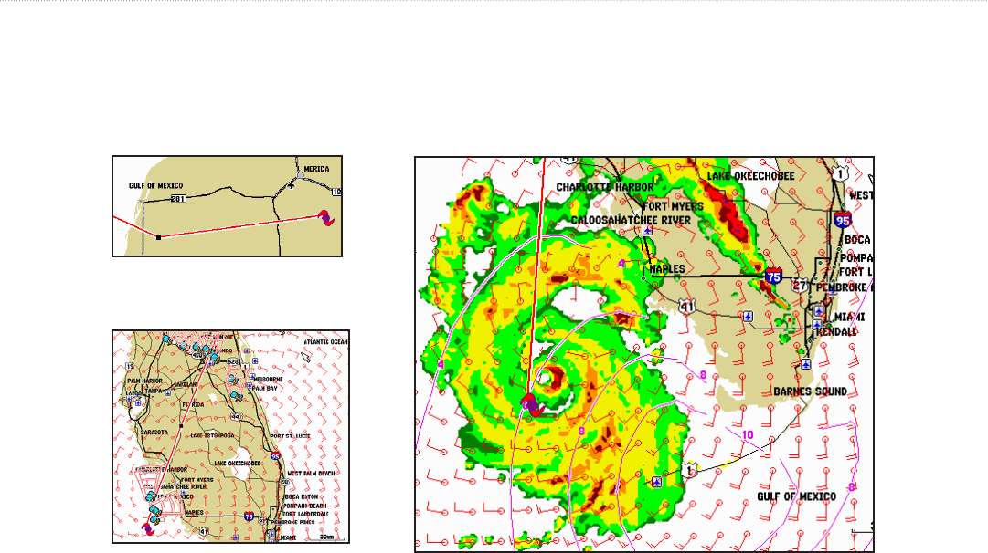
This example shows the projected path of
Hurricane Charley through Florida in August,
2004. Wind and storm cells are also visible.
In this example, this hurricane is projected
to travel west-southwest before moving in
a northwesterly direction.
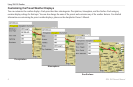
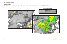
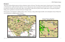
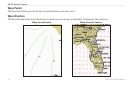
In this example of Hurricane Charley in August, 2004, NEXRAD data,
wave height, and wind are shown.
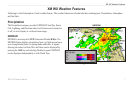
XM WX Weather Features