


GPSMAP 4000/5000/6000/7000 Series Weather and XM Satellite Radio Supplement 7
XM WX Satellite Weather and Cellular Weather
Viewing Fishing Information
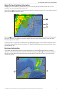
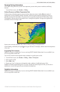
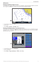
The weather Fishing chart shows present water temperature, present surface pressure conditions, and shing
forecasts.
From the Home screen, select > .
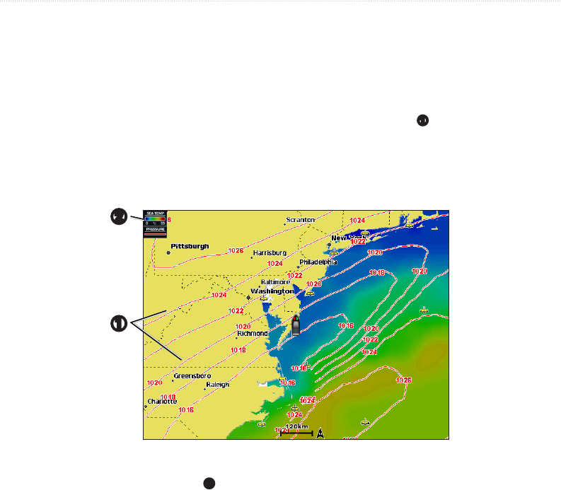
Surface Pressure and Water Temperature Data
Surface-pressure information appears as pressure isobars and pressure centers. Isobars
➊
connect points of
equal pressure. Pressure readings can help to determine weather and wind conditions. High-pressure areas are
generally associated with fair weather. Low-pressure areas are generally associated with clouds and the chance
of precipitation. Isobars packed closely together show a strong pressure gradient. Strong pressure gradients are
associated with areas of stronger winds.
➊
➋
Pressure units are shown in millibars (mb), inches of Mercury (inHg), or hectopascals (hPa).
Colored shading, as dened by the legend
➋
in the upper-left corner of the display, indicates the surface temperature
of the water.
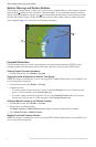
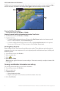
Forecasting Fish Locations
This feature is available only if you are receiving XM WX Satellite Weather data. It is not available if you
are receiving cellular weather data.
You can show areas that contain optimal weather conditions for specic species of sh.
1. From the Home screen, select > > > .
2. Select a species of sh.
3. Select > .
4. Repeat steps 2 and 3 to show areas with optimal weather conditions for additional species of sh.
Shaded areas indicate optimal shing areas. If you have selected more than one species of sh, you can select a
shaded area to view the sh species that are included in the shaded area.
Visibility Information
This feature is available only if you are receiving XM WX Satellite Weather data. It is not available if you
are receiving cellular weather data.