


6 GPSMAP 4000/5000/6000/7000 Series Weather and XM Satellite Radio Supplement
XM WX Satellite Weather and Cellular Weather
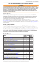
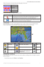
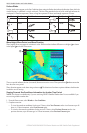
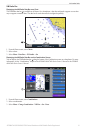
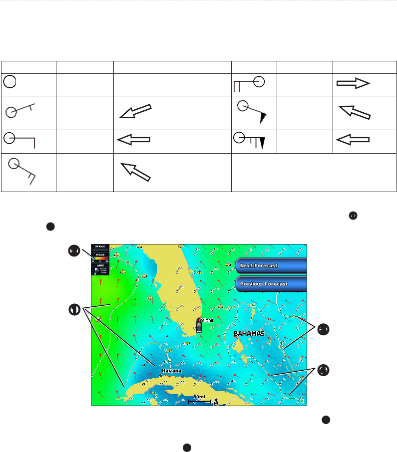
Surface Winds
Surface wind vectors appear on the Sea Conditions chart using wind barbs that indicate the direction from which the
wind is blowing. A wind barb is a circle with a tail. The line or ag attached to the tail of the wind barb indicates the
wind speed. A short line represents 5 knots, a long line represents 10 knots, and triangle represents 50 knots.
Wind Barb Wind Speed Wind Direction Wind Barb Wind Speed Wind Direction
Calm 20 knots
5 knots 50 knots
10 knots 65 knots
15 knots
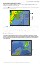
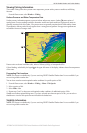
Wave Height, Wave Period, and Wave Direction
Wave heights for an area appear as variations in color. Different colors indicate different wave heights
➊
, as shown
in the legend
➋
on the left of the screen.
➋
➌
➊
➍
The wave period indicates the time (in seconds) between successive waves. Wave period lines
➌
indicate areas that
have the same wave period.
Wave directions appear on the chart using red arrows
➍
. The direction of each arrow pointer indicates the direction
in which a wave is moving.
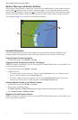
Viewing Forecast Sea Conditions Information for Another Time Period
This feature is available only if you are receiving XM WX Satellite Weather data. It is not available if you
are receiving cellular weather data.
1. From the Home screen, select > .
2. Complete an action:
• To view forecasted sea conditions for the next 12 hours, select , and to view forecasts up to 48
hours, in 12-hour increments, select again.
• To view the forecasted sea conditions for the previous 12 hours, select and to view
previous forecasts, up to 48 hours ago, in 12-hour increments, select again.