


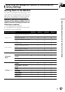

Positioning technology
Positioning by GPS
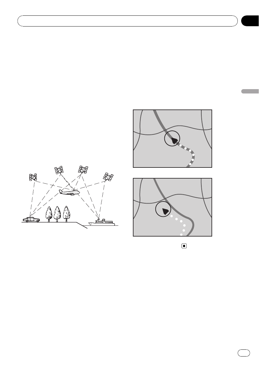
The Global Positioning System (GPS) uses a
network of satellites orbiting the Earth. Each
of the satellites, which orbit at a height of
21000km, continually broadcasts radio sig-
nals giving time and position information. This
ensures that signals from at least three can be
picked up from any open area on the earth’s
surface.
The accuracy of the GPS information depends
on how good the reception is. When the sig-
nals are strong and reception is good, GPS
can determine latitude, longitude and altitude
for accurate positioning in three dimensions.
But if signal quality is poor, only two dimen-
sions, latitude and longitude, can be obtained
and positioning errors are somewhat greater.
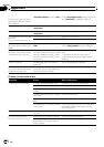
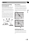
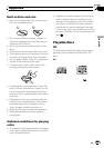
Map matching
As mentioned, the positioning systems used
by this navigation system are susceptible to
certain errors. Their calculations may, on occa-
sion, place you in a location on the map where
no road exists. In this situation, the processing
system understands that vehicles travel only
on roads, and can correct your position by ad-
justing it to a nearby road. This is called map
matching.
With map matching
Without map matching
Handling large errors
Positioning errors are kept to a minimum by
combining GPS and map matching. However,
in some situations, these functions may not
work properly, and the error may become big-
ger.
Appendix
En
119
Appendix
Appendix